+200 VISUAL MAPS FOR UK LANDSCAPERS
Garden construction clearly explained, visual and straight to the point
For landscaping students, apprentices and professionals building their site knowledge. Planning, groundworks, paving, drainage, fencing, decks, lawns and practical checks — one topic per visual map.
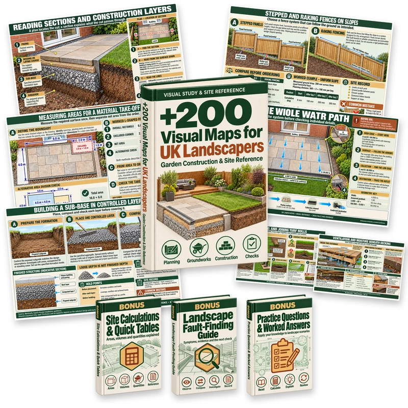
You can see the paving, the ground, the drainage and the finished garden — but how do the details fit together? Follow annotated drawings, work through calculations and compare real-world situations. Find the topic, understand the detail and connect it to the wider job.
Explore selected pages from the planned collection on mobile, tablet or computer.
Some of the visual mapsin the collection
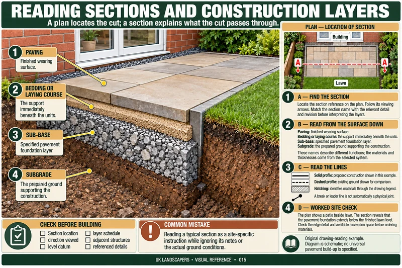
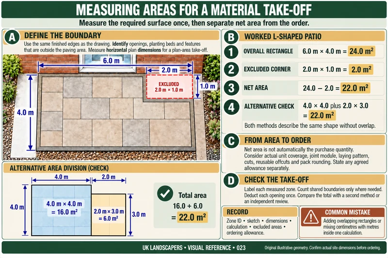
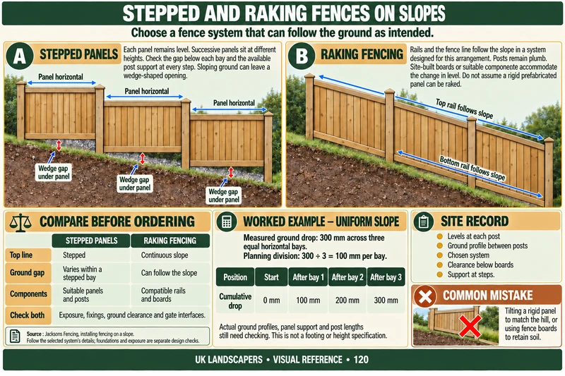
Organised by topic, including:
Planning & measurement
Read plans, sections and levels. Follow worked examples for areas, dimensions and material take-offs.
Ground preparation
Identify the ground, formation and supporting layers, and understand why their roles differ.
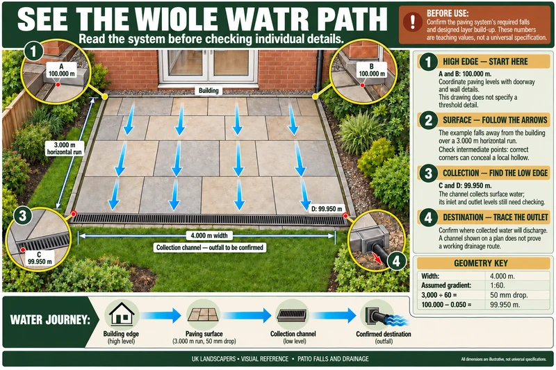
Patios & paving
Connect the finished surface to its build-up, edges, joints, laying pattern and intended water path.
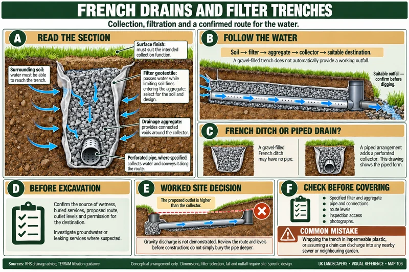
Drainage
Trace where water comes from, where it collects and where it can go before choosing a solution.
Fences & gates
Compare fence arrangements, components and interfaces with sloping ground and gate openings.
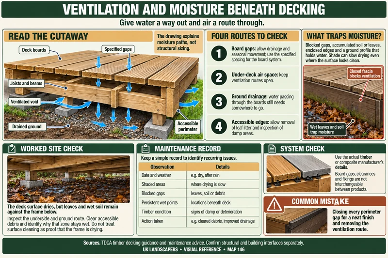
Decks & garden structures
Recognise deck components, ventilation, drainage and details that need product-specific design.
Lawns & planting beds
Understand soil preparation, turf establishment, planting areas and early care.
Problems & site checks
Separate symptoms from evidence, compare possible explanations and identify the next useful check.
What's inside
Planning & Measurement
Site observations, drawings, setting out and levels. Use annotated plans and worked geometry to connect a dimension on paper to a site decision.
Ground Preparation
Topsoil, subsoil, formation and pavement foundations. Understand the role of each layer and the information needed before construction.
Patios & Paving
Materials, patterns, cuts, joints, edges and finished surfaces. Read the construction detail as well as the visible result.
Drainage
Surface water paths, collection points, drainage arrangements and destinations. Compare observations before assuming that every wet area needs the same solution.
Fences & Gates
Posts, panels, rails, boards and gate interfaces. Compare stepped and raking arrangements and check the requirements of the selected system.
Decks & Garden Structures
Components, supports, interfaces, ventilation and drainage. Recognise where dimensions and fixings need a designed specification.
Lawns & Planting Beds
Soil preparation, turf laying, planting areas and establishment. Connect the preparation to the care needed after the work.
Problems & Site Checks
Symptoms, observations and possible causes. Compare situations and identify the next useful measurement or investigation.
Understand it, don't just memorise it.
Garden construction made visual, practical and easier to follow.
A plan shows one view. A specification describes another. These maps bring drawings and explanations together: a panorama to see the parts, a worked example to follow the calculation, or a comparison to distinguish similar situations. Use them alongside your training and the relevant project and product information.
EXPLORE THE COLLECTION →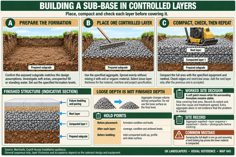
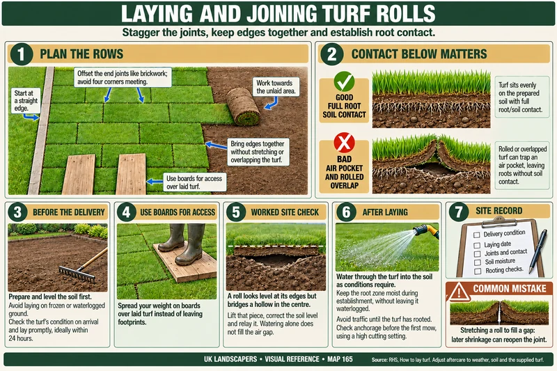
Who this material is for
YOU'RE A LANDSCAPING STUDENT OR APPRENTICE
Connect the terms you learn in training with drawings of site layouts, materials and construction details.
YOU'RE REVISING YOUR TRAINING
Review one subject at a time and use the practice questions to check whether you can explain it in your own words.
YOU WANT AN ORGANISED SITE REFERENCE
Keep diagrams, calculation methods and observation points together, ready to consult alongside the project drawings and product instructions.
YOU'RE BUILDING YOUR LANDSCAPING KNOWLEDGE
Study the wider subject, from planning and ground preparation to paving, drainage, fencing and green areas.
YOU TRAIN OR SUPPORT OTHER PROFESSIONALS
Use an annotated drawing to explain a layer, compare arrangements or discuss the evidence in an illustrative case.
YOU LEARN BEST WITH DIAGRAMS
See the layout, labels and explanation together, so you can connect the information without jumping between pages.
What you get
+200 Visual Maps for UK Landscapers — Garden Construction & Site Reference
- A planned collection of more than 200 maps across eight topics. Explore completed pages on this site.
- Planning & Measurement.
- Ground Preparation.
- Patios & Paving.
- Drainage.
- Fences & Gates.
- Decks & Garden Structures.
- Lawns & Planting Beds.
- Problems & Site Checks.
- One topic per map, with annotated diagrams, comparisons, worked examples and practical checks.
- Garden construction and establishment, written in British English.
- Digital reference pages for screen reading and personal printing. No physical books are supplied.
And that's not all…
Three companion guides give you another way to calculate, investigate and practise.
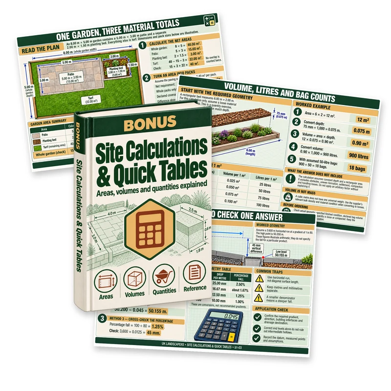
Site Calculations & Quick Tables
Three reference sheets covering areas and pack counts, volumes and litres, and gradient conversions. Worked calculations keep the assumptions and units beside each answer.
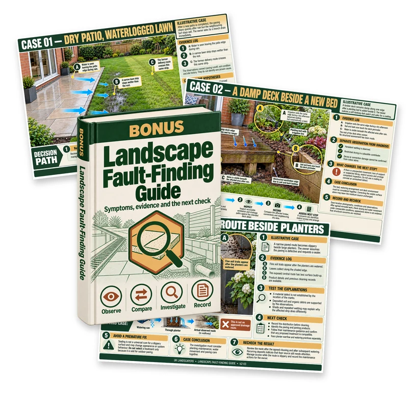
Landscape Fault-Finding Guide
Three illustrated cases connect paving and lawns, decks and planting, and paths and maintenance. Follow the evidence, compare hypotheses and choose the next useful check.
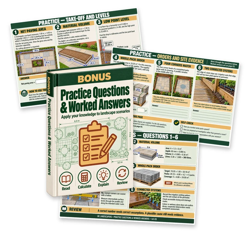
Practice Questions & Worked Answers
Six original exercises on quantities, levels and site evidence. Two question pages give you room to work; a separate answer page explains the calculations and reasoning.
THE COLLECTION: +200 VISUAL MAPS + 3 BONUSES
Eight topics, one organised reference:
ONE-OFF PAYMENT · LIFETIME ACCESS
THE COMPLETE COLLECTION
+200 Visual Maps for UK Landscapers
Eight topics in garden construction, plus three companion guides for calculations, case reasoning and practice.
- Planned collection: +200 maps across eight topics.
- Planning, measurement and ground preparation.
- Patios, paving and drainage.
- Fences, gates, decks and garden structures.
- Lawns, planting beds and establishment.
- Problems, evidence and practical site checks.
- Bonus 1: Site Calculations & Quick Tables.
- Bonus 2: Landscape Fault-Finding Guide.
- Bonus 3: Practice Questions & Worked Answers.
- Digital pages for phone, tablet and computer.
- Printable pages for your reference folder.
Purchases are not open yet.
£27
One-off payment. Lifetime access. No subscription.
No payment is taken on this page.
See the detail. Follow the reasoning. Find the topic you need.

15-DAY MONEY-BACK GUARANTEE
Take 15 days from your purchase to explore the maps and the three companion guides.
If the collection is not right for you, request a full refund within 15 days of purchase.
For support or a refund request, email support@octomaps.online.
✔ 15-day guarantee ✔ Lifetime access ✔ One-off payment
How access works
The planned digital delivery:
Complete your order
When orders open, review the purchase terms and available payment options before paying.
Receive your access
Delivery instructions will explain how to open your digital resources after a confirmed purchase.
- Lifetime access to your collection
- Support: support@octomaps.online
- For computer, tablet and mobile
Open your four resources
- +200 Visual Maps for UK Landscapers.
- Site Calculations & Quick Tables.
- Landscape Fault-Finding Guide.
- Practice Questions & Worked Answers.
Find the topic you need
Choose a topic, open the map and follow the drawing with its explanation. Use the companion guides for a calculation, an integrated case or a practice exercise.
Frequently asked questions
1. What is +200 Visual Maps for UK Landscapers?
A planned digital study and reference collection covering eight areas of garden construction and establishment, with three companion guides. This page shows completed examples; the full collection is not yet available to purchase.
2. Who is it for?
Landscaping students, apprentices and professionals building or refreshing their understanding of garden construction. Use it alongside training, project information and product documentation.
3. Does it cover every area of landscaping?
It covers planning, groundworks, paving, drainage, fencing, decks, lawns, planting beds and practical checks. It is not a complete horticulture encyclopaedia, structural design manual or professional qualification.
4. Can I use it to revise my training?
Yes. The topic-by-topic format and explained practice answers support revision. The pack is not affiliated with an awarding body and does not promise coverage of a particular exam.
5. Is it intended for the UK?
Yes. The language and examples are intended for a UK audience. Check the requirements applying to the site, project and selected products; a general reference does not replace those sources.
6. How do I get access?
The collection costs £27 as a one-off payment, with lifetime access and no subscription. Purchases are not open yet; delivery instructions will be provided when orders open. No payment is taken on this page.
7. Can I read it on my phone?
Yes. The PDFs can be opened on a phone, tablet or computer. A larger screen can make detailed diagrams easier to study.
8. Can I print the maps?
Yes. You can print pages for your own study and reference. Your purchase does not include permission to resell or redistribute the files.
9. Do I need prior knowledge?
The maps explain concepts visually. Training and supervised experience will help you apply them appropriately. They do not authorise untrained people to undertake work requiring competence or specialist design.
10. What are the purchase and refund terms?
You pay £27 once for lifetime access. Your purchase includes a 15-day money-back guarantee: to request a full refund within 15 days of purchase, email support@octomaps.online. Contact the same address for support.